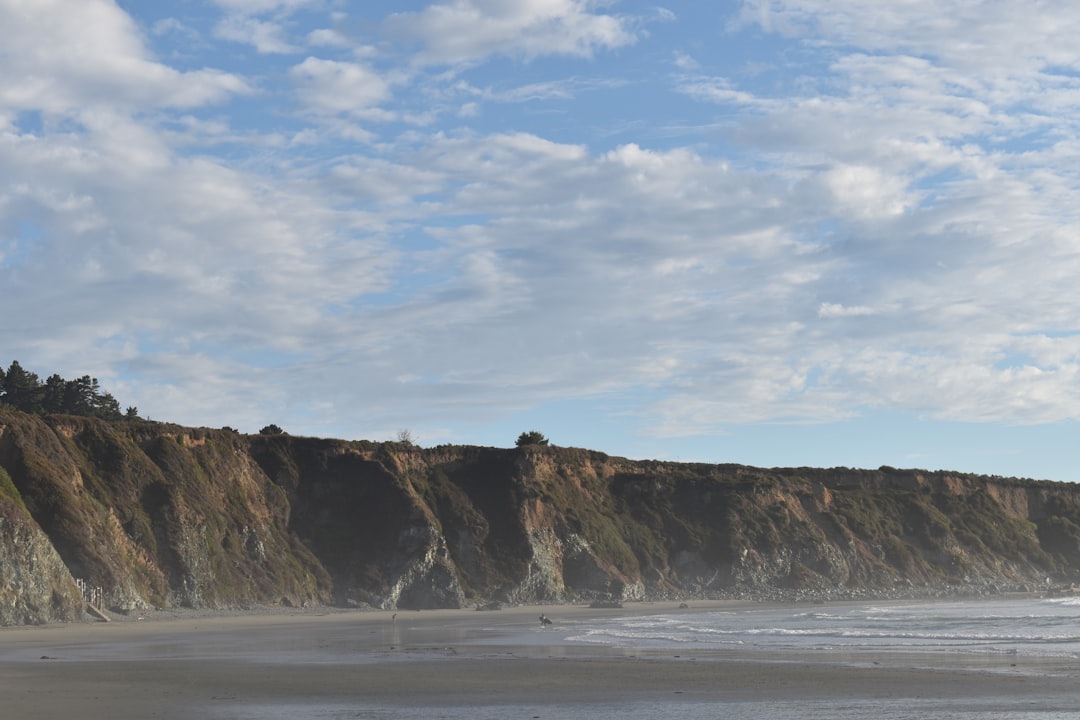
There’s a stretch of NC-12 south of Buxton where the pavement runs close enough to the ocean that you can watch spray cross the road on a rough day. Local guys at the bait shop will tell you that road used to be inland. That the beach used to be out there, past the guardrail, further than you can now see. They’re not exaggerating.
Buxton Beach — and really the entire Cape Hatteras seashore flanking it — has been one of the most actively engineered, repeatedly retreated-from, and stubbornly re-engineered shorelines on the East Coast for the better part of a century. If you’re buying property anywhere near it, you need to understand not just what the lot looks like today, but what forces have been pulling and pushing that beach for decades.
The engineering impulse: groins, sandbags, and the fight that never quite ends
The Army Corps of Engineers first got serious about Hatteras Island shoreline stabilization in the mid-twentieth century, responding to the same thing every coastal manager eventually responds to: infrastructure at risk. In Buxton’s case, the concern was ultimately the lighthouse, the road, and the Coast Guard facilities that made the Cape strategically important.
Groins went in. Hard structures designed to interrupt longshore sediment drift and trap sand on the updrift side. The physics work — locally, temporarily — but what they do to the downdrift beach is a problem you’re just relocating, not solving.
Beach nourishment came in cycles after that. Sand pumped from offshore borrow sites, spread on the beach face, and then watched closely as wave energy redistributed it over the following seasons. The Army Corps has run multiple nourishment projects along this stretch; last I checked, individual project costs in the Hatteras Island area have ranged from tens of millions to over a hundred million dollars depending on the scope, and the sand doesn’t stay put forever. Nourishment typically buys years, not decades.
The famous 1999 relocation of the Cape Hatteras Lighthouse — moved roughly 2,900 feet southwest to get it away from the encroaching shoreline — is the clearest statement of how this conflict has gone. The engineers tried everything else first. Moving a 198-foot brick structure across soft barrier island terrain was the option they reached when the shoreline engineering stopped being enough.
What the historical maps actually show
NOAA maintains historical shoreline data going back to the mid-1800s, and when you overlay those surveys on a modern chart, the picture at Buxton is stark. The shoreline has migrated landward significantly over the long run — with episodic advances during storm recovery periods that can create a false sense of permanence.
The barrier island itself is migrating. That’s not a flaw in the system; it’s how barrier islands work. They roll over themselves, with storm overwash depositing sand on the sound side while the ocean face erodes. Buxton sits at the Cape, where the island bends, and the cape itself has been known to migrate by hundreds of feet in a single major storm event.
For a buyer, the key question isn’t “is the beach eroding” — it is, on a geologic timescale — but “what does the current FEMA Flood Insurance Rate Map show for this parcel, and when was the last time the community went through a map revision.” FEMA map updates along Dare County have changed base flood elevations and zone designations in ways that directly affect insurance costs. Worth confirming the current map panel before you make any offer.
How this affects what you’re actually buying
Base flood elevations in the Buxton area — last time I pulled a FIRM panel for that stretch — were running in the range of 11 to 14 feet NAVD88 for properties closest to the ocean, with some parcels in VE zones carrying wave action designations on top of that. Flood insurance on a VE-zone structure can be a significant line item; deductibles I’ve seen quoted in that corridor run from $5,000 to $10,000 or higher on the wind side, with flood policies layered separately.
Dare County also enforces oceanfront setback requirements tied to the rate of shoreline change, calculated by the NC Division of Coastal Management. Those setback lines get revised periodically based on updated erosion rate data. I wouldn’t close on an oceanfront or near-oceanfront lot in Buxton without confirming the current setback line applies to that parcel — and that any existing structure is compliant. A house built in 1985 may have been legal at the time and now sit closer to the line than current rules would permit for new construction, which affects what you can do if you need to rebuild.
The Dare Waterways Commission has also flagged broader navigation and sediment concerns in the region that are worth understanding in context — because what happens in the inlets affects longshore drift patterns, which affects the beach you’re standing on.
The nourishment dependency question
Here’s the practical issue nobody in a brochure will say directly: some of the beach you see at Buxton today exists because federal money paid to put it there. When that funding cycles end, or when appropriations slow down, the beach narrows. There have been stretches of years along Hatteras Island where nourishment projects stalled and the shoreline response was visible within a season or two.
That’s not a reason not to buy — plenty of buyers understand the trade and make peace with it. But it means the beach in the listing photos was not necessarily the beach last December, and it may not be the beach in three years. Ask specifically: has this property been subject to a nourishment project, and if so, when was the most recent one.
If you’re in the area for a showing and you want some orientation on storm exposure before you commit to a specific parcel, the Hurricane Preparedness Forum coming to Hatteras is a legitimate resource — not marketing, just people who know the island talking about what actual storm events look like from the ground.
What to do before you make an offer
Run this checklist before you spend real money on due diligence:
- Pull the current FEMA FIRM panel for the parcel — confirm the flood zone, base flood elevation, and the panel effective date.
- Request a current elevation certificate, not one from the original construction permit. A lot can change in ten years.
- Contact the NC Division of Coastal Management to confirm the current static vegetation line and oceanfront setback for the specific lot.
- Ask your insurer for a quote before you’re under contract — not after. Flood and wind together on an oceanfront Dare County property can come as a surprise.
- Look at NOAA’s historical shoreline tool and locate the parcel on the overlay. See where the shoreline sat in 1970, 1985, and 2005.
- Ask about any known nourishment history and whether the property falls within an Army Corps project area.
The shoreline at Buxton is not frozen. It has never been frozen. Decades of engineering have slowed the change and redirected it and occasionally reversed it temporarily, but the island is still moving, still responding to storms, still dependent on decisions made in Washington about what gets funded. The best thing you can do as a buyer is go in with your eyes open about that history — and then decide if the property still makes sense on its own terms.