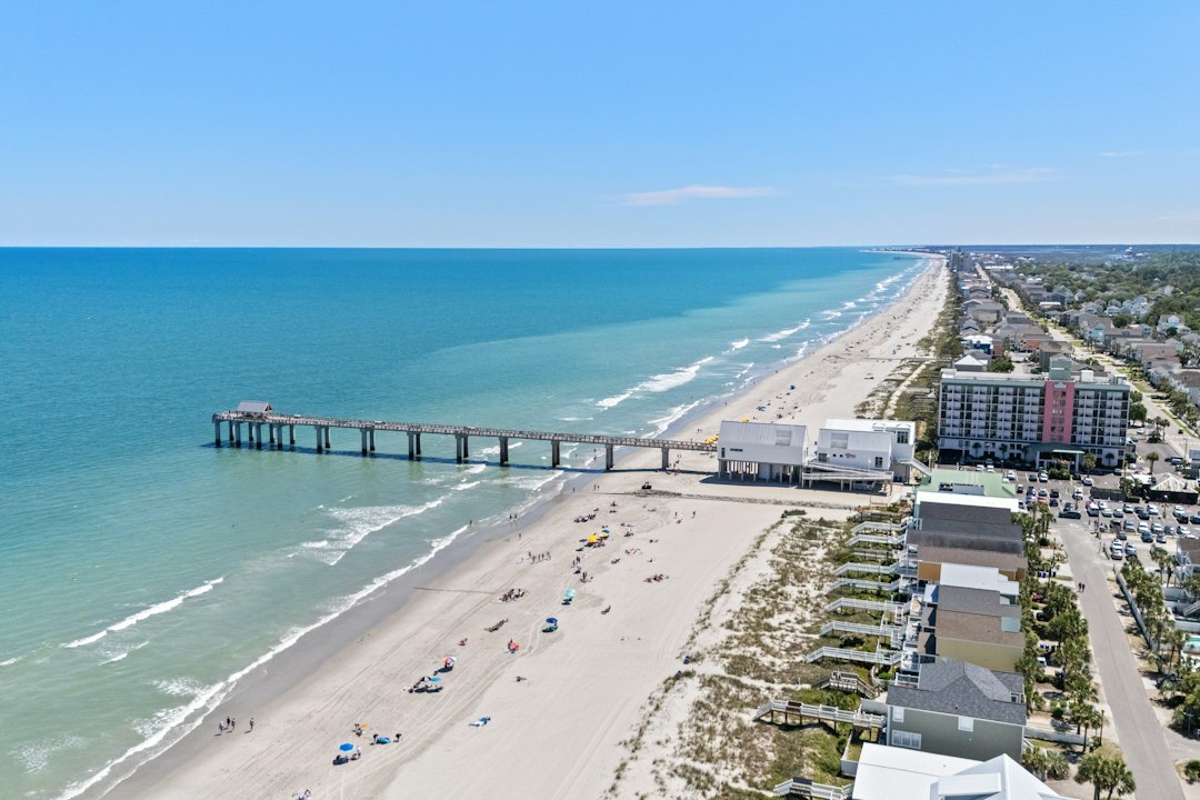
Every serious buyer I’ve walked through a Hatteras Island property has eventually asked some version of the same question: “What happens when the road closes?” The ones who ask it are thinking clearly. The ones who don’t are the ones who call me six months after closing, frustrated that their rental sat dark for four days in October because nobody could get in or out of Frisco.
N.C. 12 is the only road on Hatteras Island. One lane each direction, mostly at sea level, running 70-odd miles from the Wright Memorial Bridge corridor down through Nags Head, past Pea Island, through Rodanthe, Waves, Salvo, Avon, Buxton, Frisco, and out to the Hatteras ferry landing. There is no alternate route. When overwash covers it, you wait, or you don’t go.
That’s not a scare tactic. It’s the baseline condition of living on a barrier island, and if you’re going to buy here, you need to understand what it means for access, for insurance, for your rental income, and for long-term value.
What Overwash Actually Looks Like and How Often It Happens
Overwash isn’t dramatic in the way a hurricane is. Half the time it happens overnight during a nor’easter — a storm surge that rolls across the beach, deposits a foot of sand on the pavement, and recedes before dawn. NCDOT crews show up at first light with equipment, and the road reopens by midmorning. That’s the best-case version.
The worst-case version is a sustained storm event that scours the road surface, undermines the shoulder, and dumps enough material that pumping and clearing takes 12 to 36 hours. The stretch through Pea Island — that thin, exposed section north of Rodanthe where the refuge sits — closes more frequently than any other part of the corridor. Rodanthe itself has seen repeated closures, and the Dare County road closures and coastal storm impacts situation has grown more visible in recent years as storm patterns have intensified.
Dare County has been working to improve pumping response time after a notable July flooding event. That’s progress, but the underlying geography hasn’t changed: this is a dynamic barrier island system, and N.C. 12 runs across the parts that the ocean and sound would rather treat as a temporary sandbar.
Emergency Ferry Service — What It Is and What It Isn’t
When N.C. 12 is closed at the Pea Island section, NCDOT can activate an emergency ferry route from Stumpy Point on the mainland to Rodanthe. This is a genuine lifeline — it runs passenger vehicles across Pamlico Sound and keeps medical access, emergency services, and some supply movement functional when the road is out.
Here’s what it is not: it is not a substitute for the road, it is not fast, and it does not run on the same schedule as the standard Hatteras-to-Ocracoke ferry. Capacity is limited. Lines form. A crossing that takes minutes by car under normal conditions becomes a multi-hour process when demand spikes and weather is still marginal.
A few things worth understanding before you buy:
- The emergency ferry is NCDOT-operated and has historically run without fare during declared closures, though policy can change — worth confirming current status with NCDOT before closing
- Dare County has pushed for permanent toll waivers for locally registered vehicles on the standard ferry routes, which signals that ferry access and its costs are active political issues, not settled ones
- The emergency service does not accommodate all vehicle types — check current capacity limits for trucks, RVs, and trailers if that’s relevant to your use
- If you’re buying a vacation rental property south of the Pea Island closure zone, your renters need to know this option exists and how to access it — it’s not obvious if you’re from inland
How Closures Affect Rental Income and Valuation
This is where buyers sometimes go sideways. They look at gross rental revenue projections from a property manager and assume those numbers reflect a full operating year. They don’t always account for closure days.
A property in Avon or Buxton — south of the most frequent closure point — can still lose access entirely if Pea Island goes under. Your renters can’t get there from the north. If they drove south from the Outer Banks corridor, they’re stuck waiting at a gas station in Rodanthe. If they flew into Norfolk and rented a car, they have no path in at all.
In my experience, one serious closure event during peak season can cost a rental property $3,000 to $8,000 in refunds and rebookings, depending on the week, the size of the house, and how the rental manager handles it. Last I checked, the better management companies were building force majeure language into rental agreements specifically for road closures, but not all of them are, and buyers should ask before they assume.
For valuation purposes, lenders and appraisers generally don’t apply a formal “closure discount” to Hatteras Island properties — it’s baked into the market as a known regional condition. But properties in Rodanthe and the northern villages arguably carry more closure exposure than those further south, and that’s reflected, sometimes subtly, in price-per-square-foot comparisons within the island.
The Insurance Dimension
Homeowners insurance on Hatteras Island is not cheap, and it hasn’t gotten cheaper. North Carolina’s coastal homeowners insurance costs have climbed significantly — nearly 47% since 2020 by some measures — and Dare County properties sit in some of the highest-risk tiers. Wind deductibles in this zone commonly run 1% to 3% of insured value as of current market conditions, sometimes higher on older structures, and you’ll need separate flood coverage through NFIP or a private carrier regardless.
What buyers sometimes miss: your standard homeowners policy almost certainly does not cover loss of rental income due to road closures that don’t involve direct physical damage to the property. If N.C. 12 goes under for three days and your renters can’t arrive, that’s a loss-of-access scenario — not a property damage claim. Some short-term rental insurance products address this specifically. Most don’t. Read the policy, or have someone read it who will tell you the truth about what it covers.
Elevation certificates matter here. An elevated structure on a properly engineered lot in Buxton is not the same insurance proposition as a slab-on-grade house on the sound side in Waves. I wouldn’t close on any Hatteras Island lot without a current elevation certificate and a flood zone confirmation — not because the sellers are hiding anything, but because the maps get revised and the difference between AE and X zone flood insurance costs can be significant.
What to Do Before You Make an Offer
Run through this list before you get attached to a specific property:
- Pull the NCDOT closure history for the N.C. 12 segment nearest the property — not just the last year, but three to five years back if you can get it
- Ask the listing agent specifically about rental income during closure events — did the property have any refund obligations in the past two or three seasons?
- Confirm the current flood zone and ask when the elevation certificate was last updated — anything older than five years on a barrier island is worth refreshing
- Check whether the property manager’s rental agreement includes force majeure or road closure language, and what the refund policy is
- Verify current emergency ferry capacity and scheduling directly with NCDOT — the operational details shift
- Review your proposed homeowners and flood policy for loss-of-rental-income riders specific to access disruption events
The Dare County flood inundation mapping and alert network is also worth bookmarking — it gives real-time road flooding data that, as an owner, you’ll actually use.
Hatteras Island is worth buying on. I’ve spent enough time working the water from the Ocracoke inlet up past Oregon Inlet to believe that. But this island has a road that closes, and buyers who know exactly what that means before they sign are the ones who stay happy with the decision.