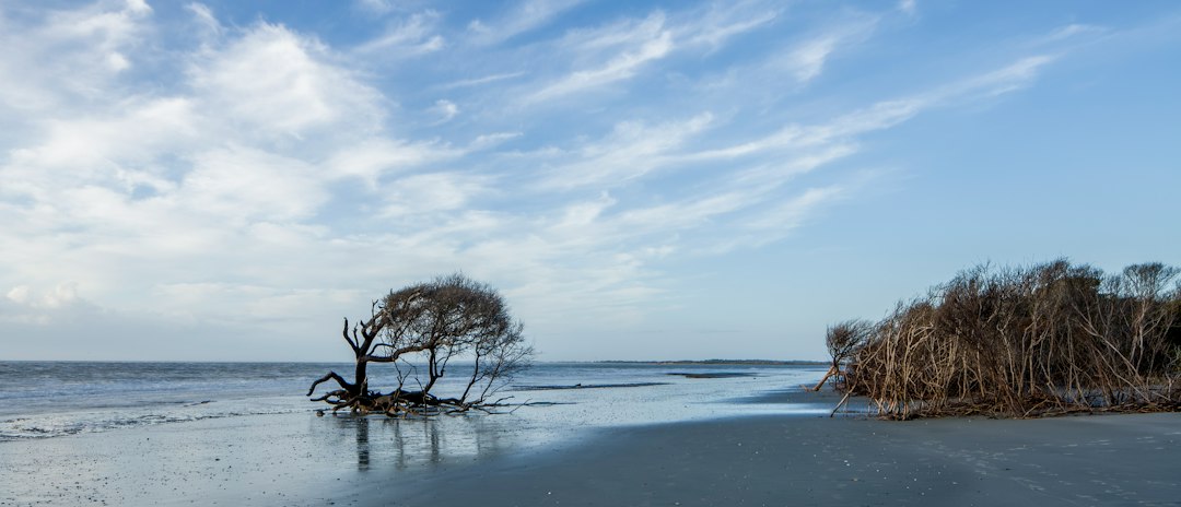
The groin repair project at Buxton has a substantial completion target of December 15. That’s the headline. But if you’re looking at oceanfront or near-oceanfront property along that stretch of Hatteras Island, the real question isn’t whether the contractor finishes on time — it’s what the project does and doesn’t protect, and what it tells you about the long-term calculus of owning land here.
I’ve watched that beach from the water plenty of times. The shoreline around Buxton has been fighting itself for decades — the Cape Hatteras area sits at one of the most geologically active points on the East Coast, where the Labrador Current and the Gulf Stream meet and the barrier island does what barrier islands do, which is move. Groins slow sediment loss along individual frontages. They don’t stop the physics.
What the Groin Repair Actually Does
Groins work by interrupting longshore drift — sand moving parallel to the beach catches on the structure and piles up on the updrift side. When the structures fall into disrepair, they lose that function and the beach can recede faster than it otherwise would.
The current project is repairing existing structures, not adding new ones. That distinction matters for a couple of reasons. First, it means the permitted scope was already established — you’re not looking at a contested new hardened-structure installation that could get challenged or delayed by the Coastal Resources Commission. Second, it means the beach configuration you’re seeing during and after this project is closer to what was historically expected at this location, not a new engineered condition.
For what it’s worth, the full history of shoreline engineering at Buxton is worth a read before you tour any oceanfront property there. The groin field has been part of that beach’s story for a long time, and understanding what came before tells you something about what’s likely to come next.
What “Substantial Completion by December 15” Actually Means in Practice
In construction contracts — especially coastal ones — substantial completion means the work is functional and the owner can use it for its intended purpose, but there’s usually a punch list. Think of it like crossing the inlet on a falling tide: you made it, but you’re watching the depth sounder and you know the cleanup run is still ahead.
A few things to keep in mind if you’re actively shopping in that market:
- Substantial completion is not final acceptance. There will likely be remaining work, inspections, and sign-off that extends past December 15. Don’t assume the project is 100% resolved on that date.
- Beach conditions will continue to evolve. Sand redistribution after groin repair doesn’t happen overnight. You may see uneven beach profiles for months.
- Any property you’re looking at should have a current survey and, if it’s oceanfront, a current CAMA setback verification. The lot lines and setback rules in this area are not static, and any competent closing attorney will tell you the same.
- Elevation certificates matter here. I wouldn’t close on an oceanfront or near-oceanfront lot in Buxton without a fresh one. FEMA flood maps for Hatteras Island have been updated in recent years, and the base flood elevation can affect your insurance premium significantly — last I checked, wind and flood deductibles for oceanfront properties in Dare County were running in the range of 2–5% of insured value for named storms, but that number is worth confirming directly with your insurer.
The Nourishment Connection
The groin repairs are happening alongside — or closely following, depending on timing — the broader beach nourishment work at Buxton. Those two projects are related in intent even if they’re managed separately. Nourishment pumps sand in; groins help hold some of it in place updrift of each structure. Neither one works as well without the other.
The Buxton beach nourishment project has its own timeline and its own implications for how the beach profile looks in the near term. If you’re making a buying decision partly based on beach width — and buyers do, especially rental investors — you want to understand that nourishment projects are periodic, not permanent, and the interval between projects depends on funding cycles that aren’t always predictable.
How to Read This Project as a Buyer
Here’s the blunt version: a repaired groin field on a nourished beach is better than a failing groin field on a narrowing beach. The December 15 target suggests the Army Corps and the project team are on track. That’s meaningful. But it doesn’t change the underlying exposure of oceanfront property on a barrier island that moves.
What it does change, potentially, is your insurance and financing picture in the short term. Some carriers get nervous about underwriting oceanfront property when active coastal engineering work is incomplete — worth asking your agent directly whether the project status affects binding coverage.
Buxton Beach Nourishment and Groin Repairs: How Coastal Engineering Affects Outer Banks Property covers the mechanics of how these projects interact with property values and insurability in more depth, if you want to go deeper on the technical side before you make an offer.
What to Do Before You Close
If you’re actively under contract on something in the Buxton area, or getting close to making an offer:
- Get a current elevation certificate — not one from 2019, not one “from the last sale.”
- Confirm CAMA setback lines with the NC Division of Coastal Management directly, not just from the listing.
- Ask your insurance agent whether the project’s substantial completion status affects when and how they’ll bind coverage.
- Check whether the property sits updrift or downdrift of the nearest groin — position relative to the structure affects how much benefit the lot receives.
- Pull the Dare County flood inundation mapping for that specific parcel. It’s available; use it.
The December 15 target is encouraging news for this stretch of beach. Just make sure you’re buying the property, not the project completion date.